

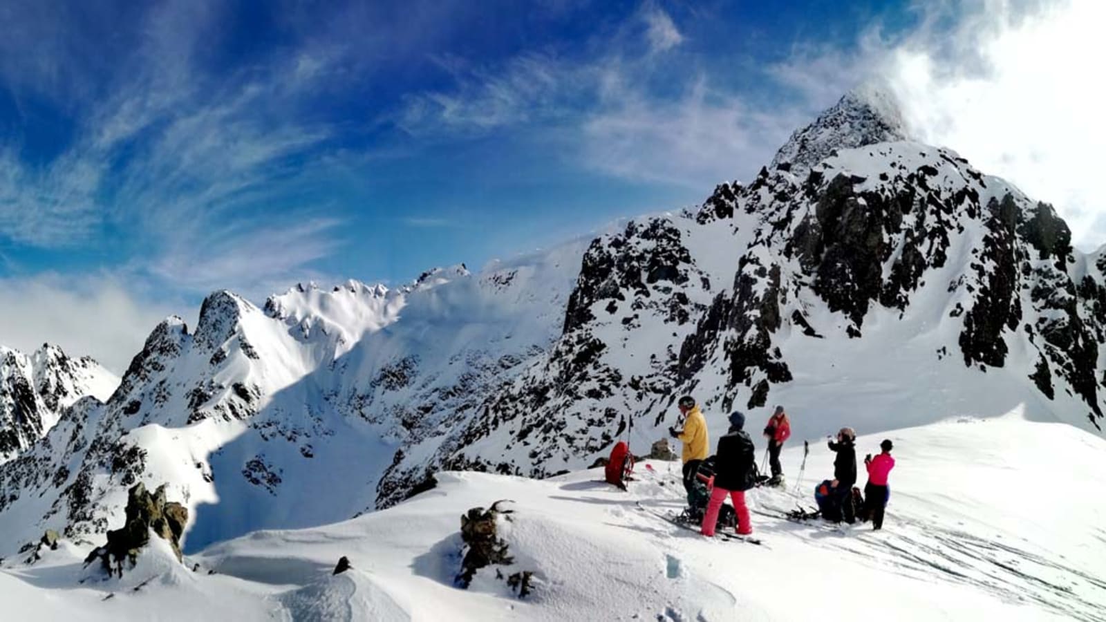
If you've taken an avalanche risk management workshop or course, you've probably come across this phrase at some point. Avalanche terrain can be a broad and complicated topic. We'll try to simplify it and share some ideas and key points you may not have heard before. I hope this encourages you to look for more information and keep studying. Recognizing where an avalanche can occur, in unstable conditions, is key to staying alive and having fun in the backcountry. We can't control the weather or the snow conditions, but we can control who we go with, when, and where.
WHAT IS AVALANCHE TERRAIN?
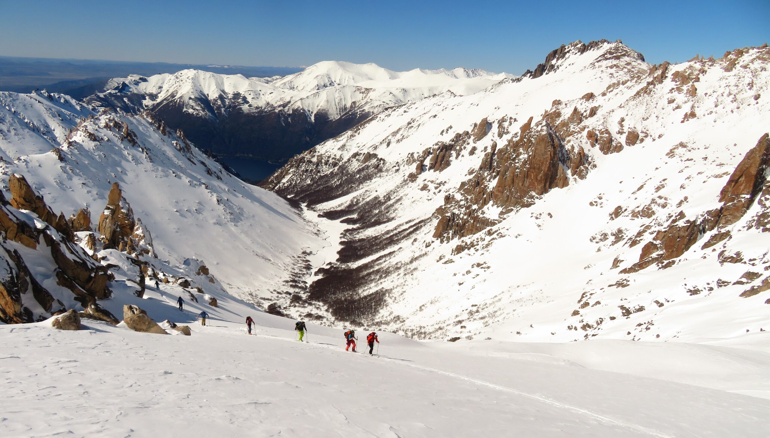
Avalanche terrain is where avalanches can occur under the right circumstances. Simply put, it's terrain steep enough for snow to slide, but not so steep that the mountain sheds it on its own. Certain types of terrain are more prone to avalanches than others because of their characteristics. Below, we'll go over what to look for and analyze on our tours.
First, it's important to understand that avalanches and avalanche accidents result from the interaction of weather, snowpack, people, and terrain. The first three factors (weather, snowpack, and people) are dynamic and constantly changing. Terrain, however, is static. It doesn't change. What changes are our decisions and route choices.
So recognizing avalanche terrain is fairly simple. Recognizing when that same terrain actually presents an avalanche hazard is the tricky part, and it can be totally uncertain. We'll cover the relationship between terrain and avalanche danger later on.
The first thing to know is that an avalanche is triggered when the pull of gravity overcomes the frictional forces holding the snow in place. Snow likes to stick to itself in layers (cohesion), and those layers generally like to stick to each other. This is a very simplified explanation; we'll develop the topic in upcoming posts.
ANALYZING SLOPE ANGLE
The steeper the slope, the harder gravity is trying to pull the snow downhill, and in avalanche terms, any slope over 25 degrees is considered "steep." Dry snow avalanches are most common on slopes of 30 to 45 degrees. Slab avalanches tend to be less frequent on slopes steeper than 45 degrees, since the snow tends to sluff off on its own. When we're talking about wet snow (from warming, rain, or melt), liquid water breaks down the bonds and avalanches can occur on lower-angle slopes, even slopes under 20 degrees.
The best way to learn slope angles is to buy and use an inclinometer. If you're a skier or snowboarder, you probably already have an idea of how steep is steep! A black diamond run is around 30-35°, a good example of avalanche terrain. But in general, we're pretty bad at judging slope angles, so to sharpen your eye there's nothing better than an inclinometer (even a phone app). When looking at a slope, the difference between 32 and 37 degrees is subtle and imperceptible to most people. Yet in unstable conditions, a five-degree change makes a huge difference.
Finally, if we think about typical Patagonian terrain and our most frequent avalanche problems, our concerns generally start at slopes of 35 degrees and up.
ANALYZING SLOPE SHAPE
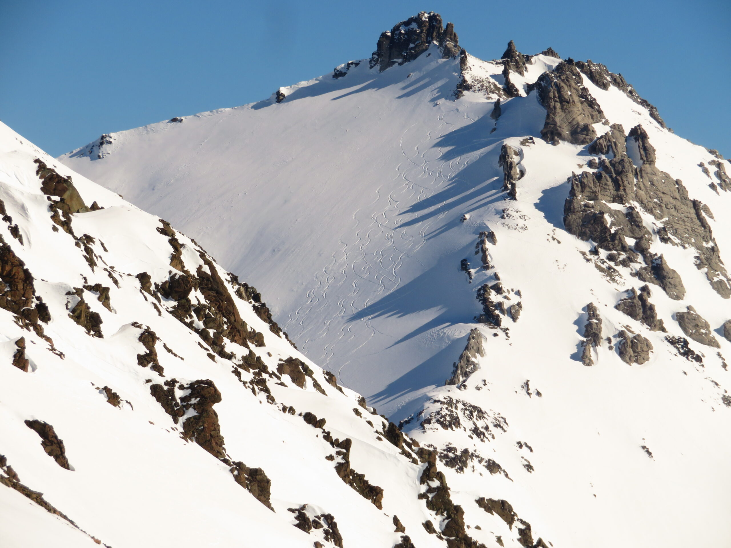
Slope shape matters: whether it's a narrow gully, multiple drainages, a wide open slope, or funnel-shaped, whether it flattens out gradually or ends abruptly. All of this aggravates the potential consequences of an avalanche.
A gully will confine and accelerate the flow. A funnel-shaped slope means even a shallow avalanche can involve a large volume of snow. If a slope eases off gradually, the debris will spread out as it comes to a stop. However, a slope that ends abruptly in a creek, a crevasse, or a road will cause even a small avalanche to pile up deeply. These are what we call "terrain traps," and they worry us because small avalanches can have serious consequences.
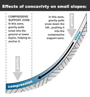
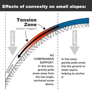
In the end, what matters is the angle of the steepest part of the slope and its shape. Is it concave or convex? It will always be easier to trigger an avalanche on terrain under tension (convexities). Likewise, depending on the avalanche problem we're facing, we can remotely trigger an avalanche from terrain connected to the problem. In the Bariloche area we rarely deal with persistent slab problems, but it's definitely something to keep in mind in continental climates (Paso Pehuenche, Las Leñas, Mendoza).
VEGETATION
Trees, or really, the lack of trees, are good indicators of avalanche paths. Broken or bent trees are signs of past avalanches. The vegetation pattern only shows that avalanches have occurred in that spot, but says nothing about present or future danger.
If we tour through the valleys of the area, we can quickly identify avalanche paths where Lengas or even Coihues (at lower elevations) have been knocked down. Many of them are in fairly steep spots that connect at the top with leeward slopes or bowls. Above all, they help us identify these places so we can be careful when crossing them or exposing ourselves to their path.
TREES AND ROCKS: ANCHORS OR OBSTACLES?
Some people think trees and rocks can help anchor the snow. Intuitively, it makes sense that they'd support the snowpack, but in practice it's not that simple. The only thing that decides whether an avalanche can release is the slope angle, and the structure of the snowpack will decide whether the snow fractures.
Closely spaced trees can offer good support. Generally, in the typical Patagonian Andean forest, Lengas form a fairly dense stand. But watch out for sloped clearings at mid elevations (La Palmera, Catedral).
As for rocks, always pay attention to what's happening around them. They are generally sensitive spots, since both radiation and wind change the thickness of the layers, sometimes leaving larger grains with little cohesion.
PLAN YOUR TOURS BASED ON THE TERRAIN
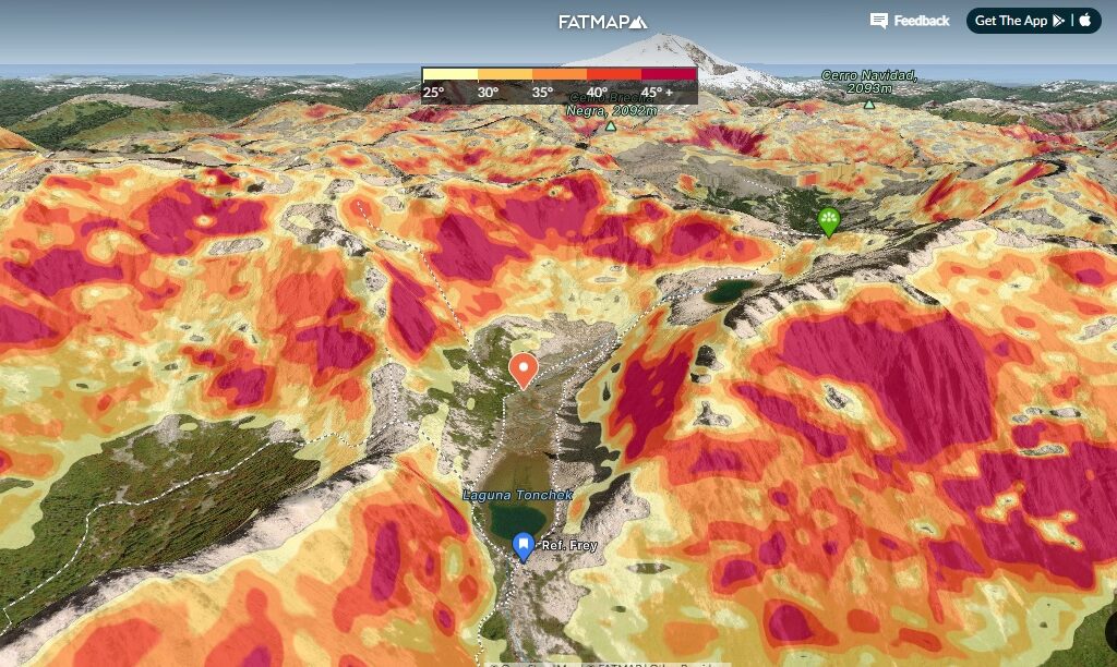
As we've seen, there are several factors to consider. And we've only named a few! To get out there more safely, planning is key. Today there are plenty of resources to help visualize terrain features such as tree cover, aspect, slope angle, the presence of terrain traps, and more. Here in Patagonia, few spots have printed guidebooks (Frey) and topographic maps with slope shading. That's why it's important to know navigation and planning tools like Google Earth, CalTopo, FatMap, and Gaia.
SO, TAKE AWAY THIS
First, slope angle is key to understanding whether an avalanche can occur in unstable conditions. Unlike the other avalanche factors, terrain doesn't change, and slopes of 35 to 45 degrees produce most of the avalanches in the area. Unfortunately, those are the slopes we most like to ski. The best way to identify terrain is to be curious and start measuring slope angles.
Second, always think about the consequences. If you don't like where an avalanche would take you and what could happen down there, don't ski that slope. Think about what the consequences could be even from a small avalanche.
Finally, recognizing avalanche terrain when the snow is unstable is the key to being able to spend all your time in the mountains and get home at the end of the day. Good knowledge of the environment, communication with your team, and the skills to travel smartly are always better than superior rescue skills.
In upcoming posts we'll classify terrain by complexity and exposure. The ATES (Avalanche Terrain Exposure Scale) classifies routes and terrain areas according to the severity of exposure to avalanche hazard. It has three terrain classes: simple, challenging, and complex. We'll see how to relate the terrain type to the avalanche danger level.
See you next time!
Fer Martinez – BC Cooperative