


Jakob is a mountain hut set inside a ski terrain system: basins, ridges, passes and slopes in every direction, at 1,600 meters, about 18 kilometers and 800 meters of elevation gain along the standard trail from Casa de Piedra. In winter it's buried in snow and becomes a backcountry paradise accessible from the Catedral ski resort.
We put together a map of the area (it's further down, for CalTopo and Google Earth), but first we want to tell you why we love this place so much.
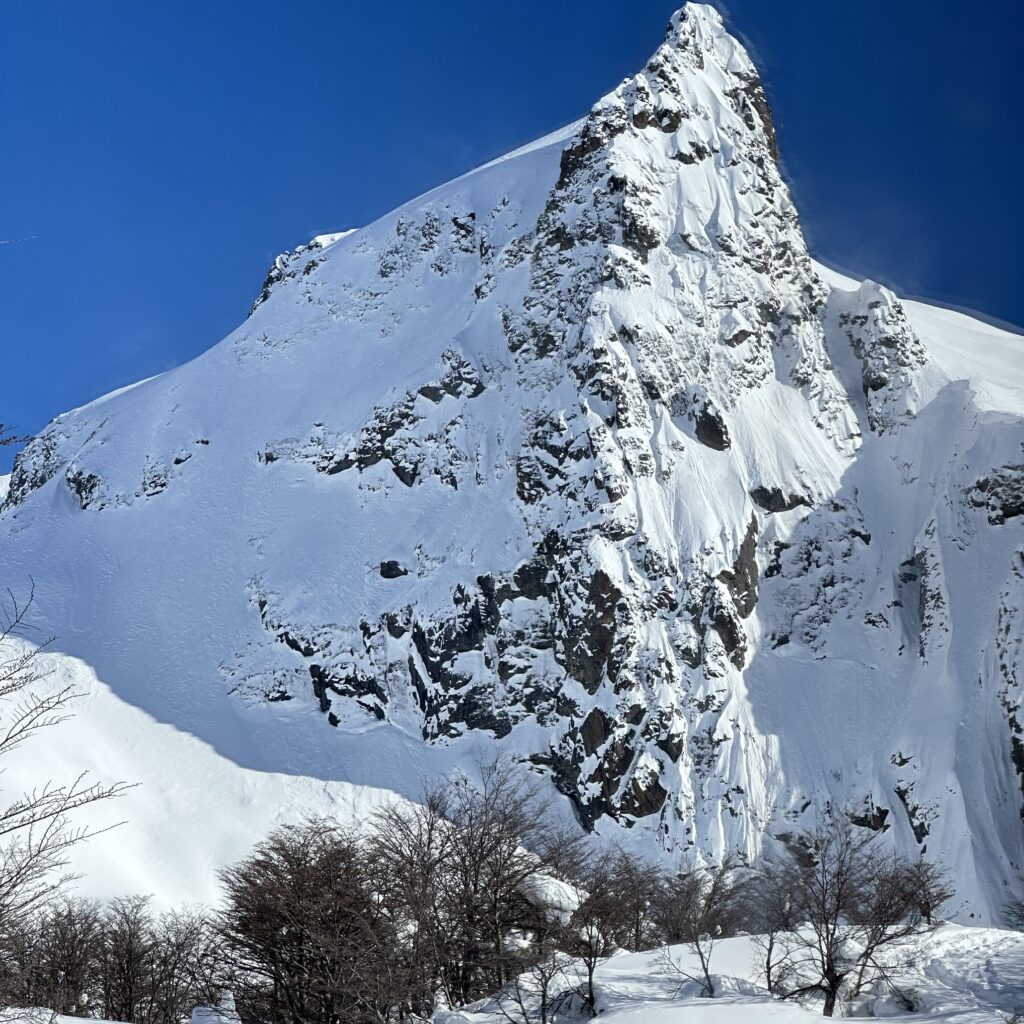
The Doctor's Lake
Before it was called Jakob, it appeared on the Instituto Geográfico Militar maps as Laguna Honda. The new name was proposed by Otto Meiling in the mid-1930s, in honor of Christofredo Jakob, a German physician who had arrived in Argentina in 1899 to hold the chair of neurology in La Plata.
Jakob wasn't a summit climber. He stayed at the Hotel Tronador, hiked up the Casalata valley with his guide, Cretón, and sat down to take in the view. One of the spots where he used to sit became known as “La mirada del doctor”. Laguna Cretón, nearby, is named after the guide.
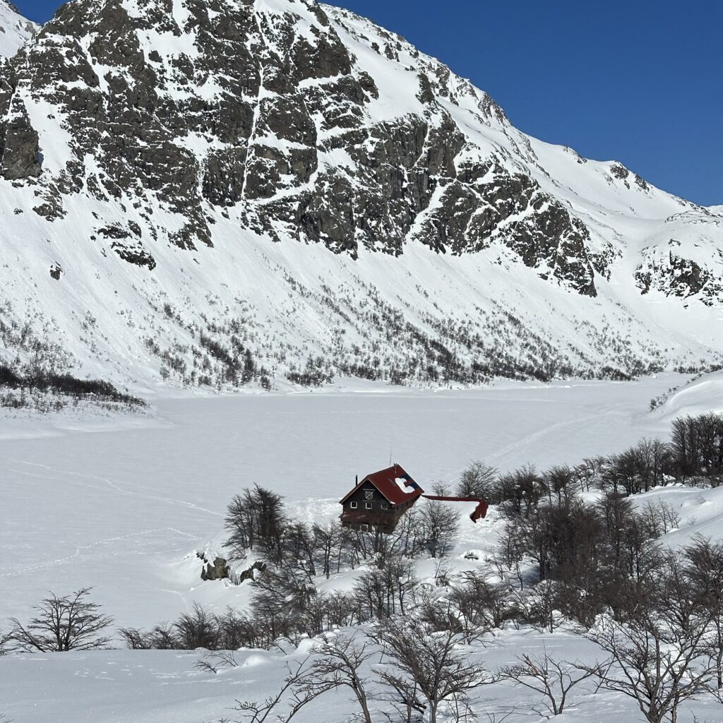
Construction of the hut began in 1950, the centennial of San Martín's death (which is why its official name is General San Martín), and it opened in February 1952. Stone and wood, right on the shore of the lake.
We like to start there because it says something about the place: Jakob was born as a mountain destination, not a tourist destination. And you can still feel that.
Thirteen People All Winter
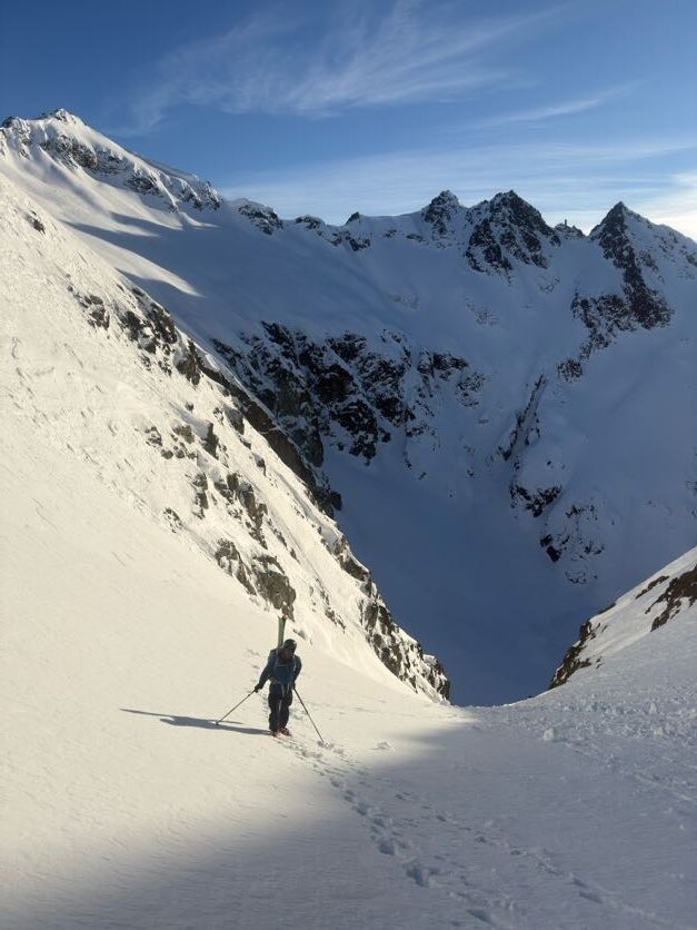
For decades, Jakob was a summer hut. In the early 1980s, Andi Lamunière and Claudio Fidani, who together add up to 27 years as Jakob hut keepers, stayed up there two winters in a row to test and promote winter activity. In an entire winter, thirteen people made it up. Claudio spent 21 days alone; Andi, two months.
The first winter with a staffed hut didn't come until 2010. That August, four skiers (three Spaniards and a Swiss) made the traverse from Frey. They set out in fog, with no track, using a map and GPS. They passed Laguna Schmoll and the Cancha de Fútbol, dropped into the Valle del Rucaco and climbed to the Brecha Negra, at 2,025 meters. On the other side they first descended with their skis on their packs, then sideslipped down a hard-snow couloir between two rock bands, all the way to a lenga forest.
And there, Laguna Jakob, completely frozen. They skied across it to the door of the hut.
Inside was Maxi, that winter's hut keeper (a different Maxi, not the one in the photo), who had been practically alone for five weeks. That night he ended up sharing the table with the Spaniards, the Swiss, two skiers from Colorado and a couple of friends who happened to have come up to visit him.
What happened the next day is, for us, the best part of the story. The plan was to continue to Laguna Negra. Maxi confirmed what they had already been told at the Club Andino: nobody had done that stretch so far that winter, the terrain was very alpine and not very skiable, and a storm was on its way. They went back to Catedral.
Just because a traverse exists on the map doesn't mean it's a good ski traverse in winter. Jakob–Laguna Negra is a classic trek in summer. In winter it's a different route, one that changes depending on snowpack characteristics, visibility and the stability of the day.
Ashes and 120 Helicopter Flights
On July 6, 2017, in the middle of winter and with the hut closed, a fire completely destroyed the historic building. By the next day, the Club Andino Bariloche had already decided to rebuild it.
Everything had to be brought up by air: about 68,000 kilos of materials in more than 120 helicopter flights, with support from Parques Nacionales, Gendarmería and the Sistema Federal de Manejo del Fuego. The hut reopened on April 21, 2018. At the ceremony were Víctor Enevoldsen and Hugo Jung, who had also been at the 1952 inauguration.
Less than a year after being reduced to ashes, Jakob once again had people sleeping around a table. That says a lot about Bariloche's hut culture.
A Map for Your Winter Trips
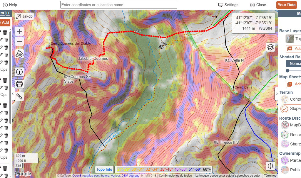
With all this in mind, we built the map. It has four approach and exit traverses (one of the Catedral to Jakob routes, Jakob to Laguna Negra exiting via López, a variant exiting via Magnat, and the ascent of Cuernos del Diablo), 14 classic runs and a few reference points, like the Puente Casa de Piedra if you ski down the NE of Tres Reyes.
Each run is rated with the ATES v2 scale. We won't explain it again here (it's covered in detail in the Frey map), but it's worth looking at how the ratings are distributed at Jakob and what that says about the place.
- 🗺️ View it online on CalTopo — you don't need an account to look at it.
- 📦 Download the files — Includes the .json to import into CalTopo (keeps folders and colors) and the .kml for Google Earth.
A Valley with a Gradient
Of the 14 runs, 3 are Simple, 5 are Challenging and 6 are Complex. At Frey, eleven out of fifteen were Complex or Extreme. Jakob has a different shape: a full exposure gradient within the same cirque. That allows something that's hard at Frey: building a progression without changing valleys, and adjusting the day's rating to the day's conditions.
The other thing that jumps out when you look at the map is that the rating belongs to the line, not the peak. Tres Reyes has one Simple run on the SW face and two Complex ones, via the S and all the way down to the Puente. Fresco II is Challenging via the S-SE and Complex via the S. A few degrees of aspect, one more couloir or a start zone overhead is enough to change the category. That's why it's worth reading the full name of the run, not just the peak, and of course assessing the day's conditions.
Simple: Valle Cella, Paso Schweitzer, Tres Reyes SW
Low-angle terrain, or terrain with short exposure that's easy to avoid. These are the options for a high-danger day, for after a storm, or for your first time in the area.
Keep in mind that Simple doesn't mean zero exposure: in valley bottoms, what's overhead counts too.
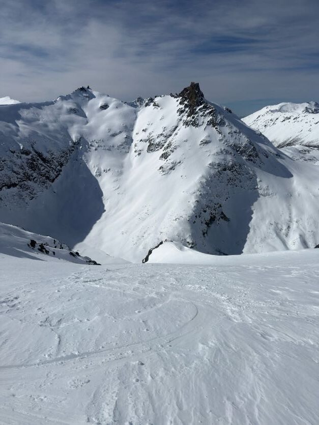
Challenging: Constructores SE-E, Brecha Negra al Refugio, Inviares N, Brecha Negra NE, Fresco II S-SE
This is the heart of Jakob. These are runs with well-defined avalanche paths, but with options: line choice, spacing and where the group regroups change the real exposure a lot.
They have very different aspects (SE-E, NE, S-SE and N), so on the same day they can be in very different conditions. It's worth looking at them one by one and not as a block.
Brecha Negra al Refugio, by the way, is the descent the Spaniards made in 2010 to reach the frozen lake.
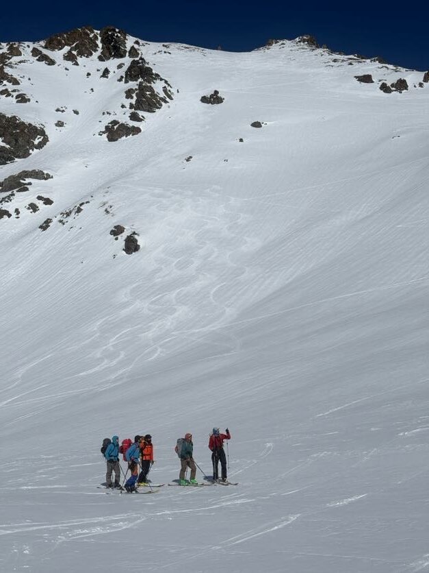
Complex: Tres Reyes S, Cuernos SE Slabs, Cella N, Tres Reyes al Puente, Pata de Gallo, Fresco II S
Terrain with multiple overlapping paths, start zones overhead and few options to reduce exposure once you're in. On these runs the decision is made before you drop in, not in the middle.
What the Map Doesn't Rate
Extreme terrain. There are no Extreme runs on the map because we mapped the classics, not because none exist. There are plenty of steeper, more committing lines that aren't included.
The traverses. The approach and exit tracks have no rating. A traverse is only as good as its most exposed section, and Jakob–Laguna Negra, in winter, has alpine sections where skiing stops being the main tool.
Conditions. ATES rates the terrain, not how it is today. At Jakob, what shapes the day most is wind: with so many aspects in such a short distance, within a few hundred meters you go from good snow to slabs and cornices. The terrain doesn't change category, but how much of it you can use does. The useful question is where the snow you want to ski today ended up.
Take it for what it is: our read of the terrain, made over days spent out there. A starting point for planning at home, to be confirmed or discarded based on what you see when you arrive.
Choosing Terrain for the Day
Jakob's gradient lets the same hut serve very different days. As a starting point:
- Exploration day — Simple terrain. Hut, Témpanos, nearby terrain and back. High danger, after a storm, little information or first time in the area. The goal is to see how the snow settled and where the wind left it.
- Ski touring day — Challenging, and Complex only in favorable conditions. Cella area or high terrain. Known stability, good visibility and a group that communicates well. This is where line choice, switching from skis to crampons and timing come in.
- Traverse day — all categories in the same day. Frey–Jakob, or eventually Jakob–Laguna Negra. The question stops being “can I ski this slope?” and becomes whether you can link the whole system safely and efficiently. It's a different discipline.
Before You Head Up
Get your ski touring permit for Nahuel Huapi National Park, tell someone where you'll be and book at the hut: refugiojakob.com.ar.
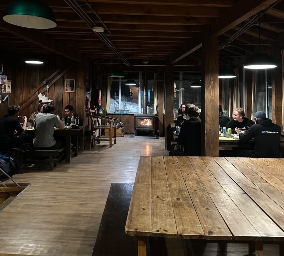
The first people to reach Jakob were looking for mountains. Those of us who go today are looking for lines. The terrain is the same and still asks for the same thing: lots of decisions. Jakob is a warm, comfortable hut with plenty of corners to explore in winter and spring.
See you in the mountains.
Fer Martinez (Mountain Guide / Cartographer / A3 ProMember)